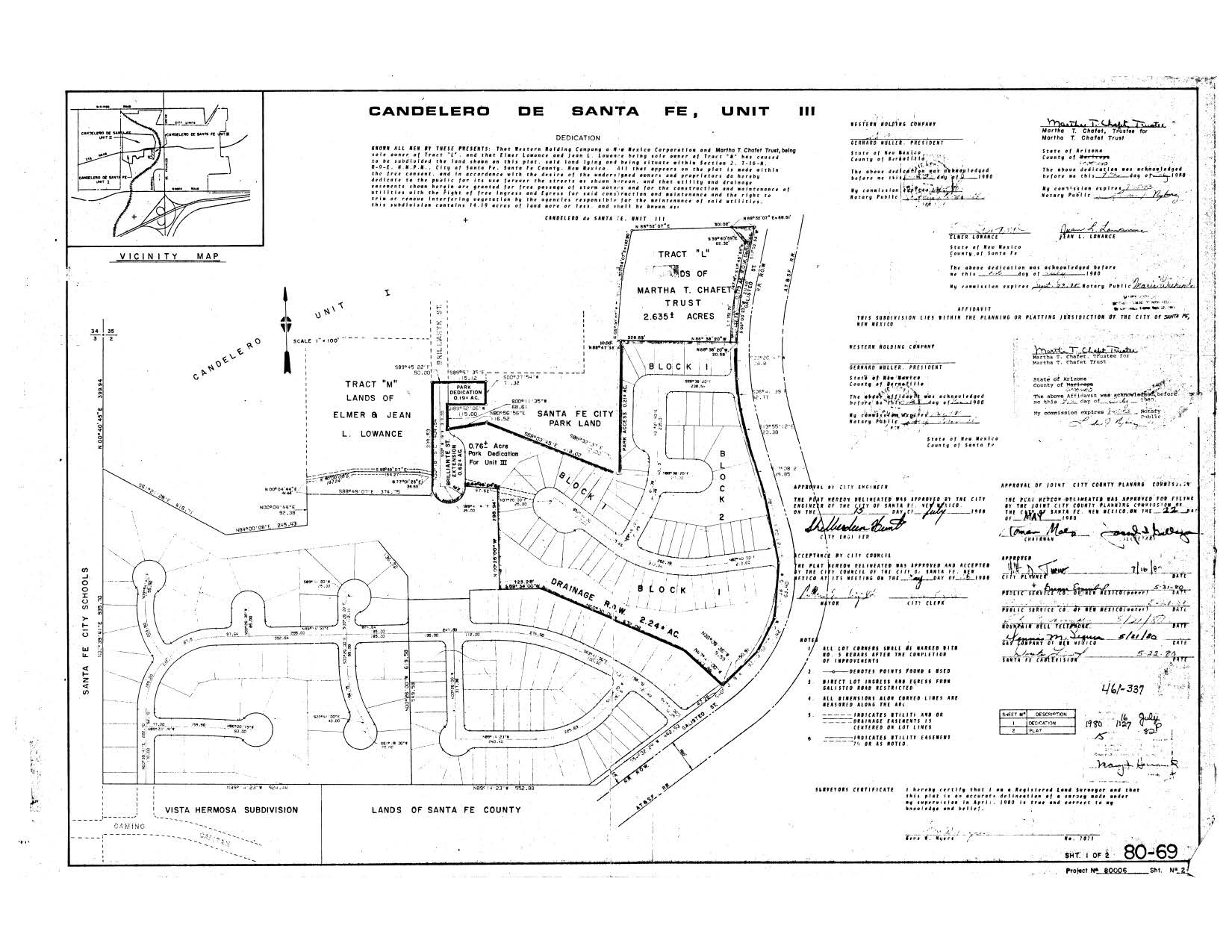
This plat map shows a strip of land with a triangle at its north, here titled galisteo road r.o.w., at Chafet's west boundary. Compare the shared county Rd 69 and Chafet boundary in The 1970 county legal description, and the 1977 zia road annexation documents and map, with the reduced land minus this strip on chafet's 2003 plat, bk 542 p. 024. This plat did not serve to dedicate this strip to the city per §3-20-11 because chafet's land was not divided for any purpose in subsection b. I.e., chafet's land was not subdivided. western holding's land was. subsequently, developers purchased chafet's land in 2003 containing the reduced acreage legal definition (minus this strip). Thus, developers are not successor in interest in Chafet's 1977 land, and city cannot vacate it under § 3-20-12. Alterntively, this strip of land is only a fraction of the width of present day galisteo road which developers propose to build on.